

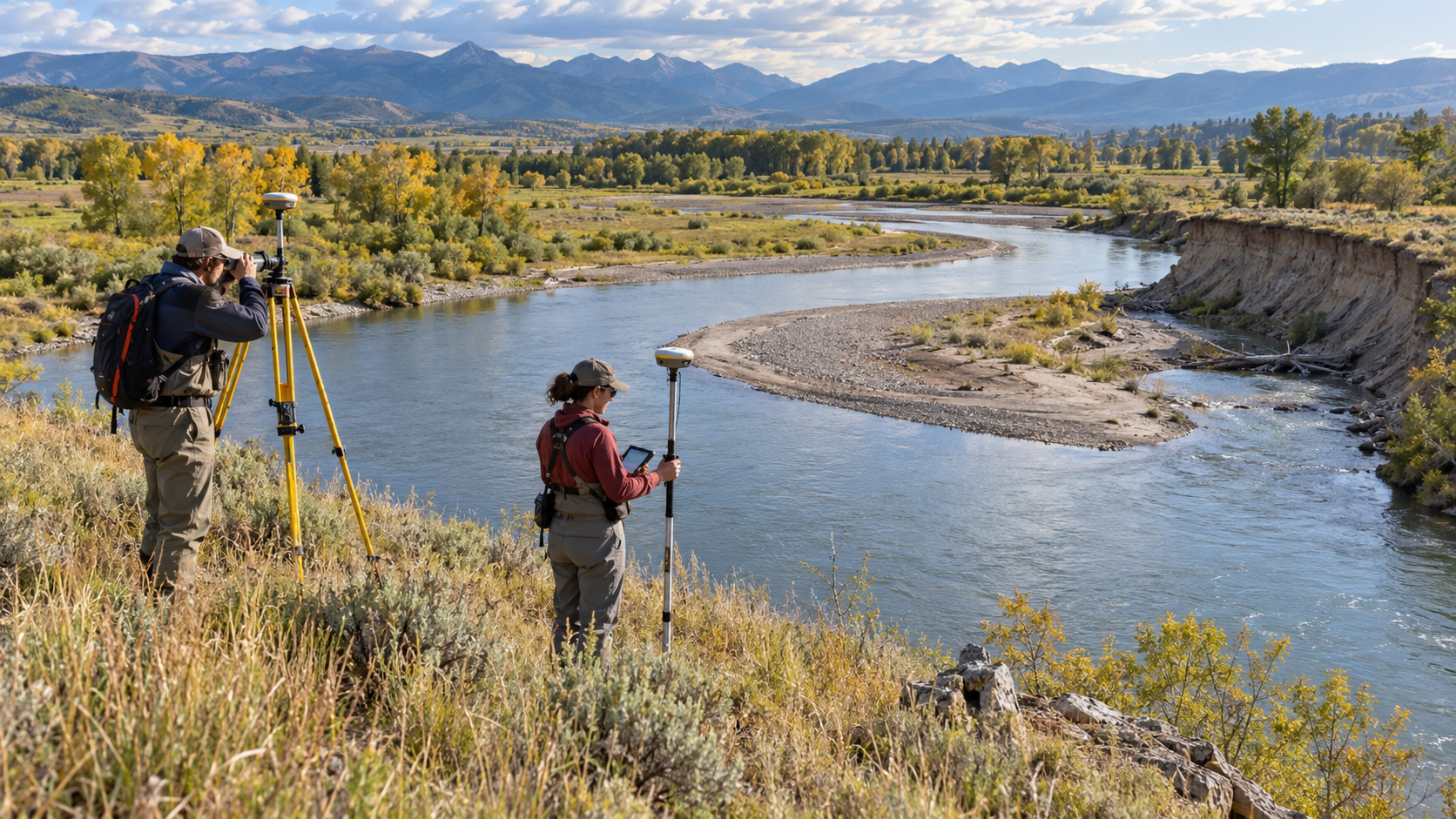
How Rivers Meander Across Floodplains Explainer
A meander is a river bend that develops and migrates across relatively low-gradient terrain. Small irregularities redirect flow, and the curved channel then creates organized differences in velocity, depth, and sediment transport. The mechanism links local conditions to larger circulation, sediment movement, chemistry, or geologic structure. Season, location, and prior conditions can change the outcome without changing the underlying physics.
Faster, deeper flow and stronger shear commonly occur near the outer bank, producing erosion and a cut bank. Slower water toward the inside of the bend deposits sand and gravel, building a point bar. Water, heat, rock, and air move along gradients, but terrain and timing shape the route.
Helical secondary circulation helps move near-surface water outward and near-bed sediment inward. Because maximum erosion can occur downstream of the bend apex, the channel may migrate sideways and down-valley rather than simply widening symmetrically. Feedbacks can strengthen or weaken the process, which is why similar settings do not produce identical outcomes.
As adjacent bends enlarge, the narrow neck between them can be breached during high flow. The river adopts the shorter path, while sediment closes the abandoned loop and may leave an oxbow lake or curved floodplain scar. Observations must cover enough space and time to distinguish a persistent pattern from a brief event.
Bank material, vegetation, sediment load, floods, valley slope, engineering structures, and upstream changes all affect migration rate. A stable-looking bend can therefore shift abruptly during a large event or remain constrained for decades. Researchers combine field instruments, remote sensing, samples, and models because no single view captures every stage.
Researchers compare historical maps, aerial imagery, lidar, cross-sections, tracers, and flow models. Meandering is not water lazily choosing the easiest path; it is an evolving feedback among fluid motion, erosion, deposition, and bank strength. The explanation is strongest when those independent lines of evidence agree within measured uncertainty.
A slight channel bend redirects the fastest flow.
Outer-bank shear erodes a cut bank.
Slower inner-bank flow deposits a point bar.
Secondary circulation moves water and sediment across the channel.
Erosion and deposition migrate the bend across the floodplain.
A neck cutoff can abandon an oxbow channel.
Explore more "Explainers"
Discover additional explainers across politics, science, business, technology, and other fields. Each explainer breaks down a complex idea into clear, everyday language—helping you better understand how major concepts, systems, and debates shape the world around us.