

How Sonar Maps the Ocean Floor Explainer
Light penetrates only a small fraction of the deep ocean, but sound can travel long distances through seawater. Sonar mapping systems send controlled sound pulses downward and listen for echoes from the seafloor. If the speed of sound in the water is known, the round-trip travel time gives the distance to the bottom. Dividing that travel distance by two produces depth.
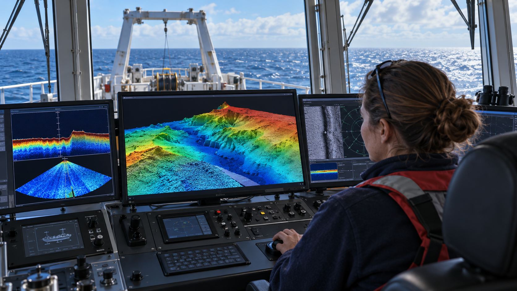
A single-beam echo sounder measures a narrow track beneath a vessel. A multibeam system sends and receives a fan of beams across the ship’s path, collecting many depth measurements at once. As the vessel advances, overlapping swaths cover an area of seabed. Navigation data place each sounding on Earth, and software combines the measurements into a bathymetric surface.
Sound speed is not constant. It changes with temperature, salinity, and pressure, so the path of a beam can bend as it passes through layers of water. Survey teams measure the water column and apply sound-speed corrections. Motion sensors track the ship’s roll, pitch, heave, and heading, while precise timing and position systems correct where each beam was pointed when the echo returned.
The strength and shape of the echo can reveal more than depth. Hard rock, soft sediment, slope, roughness, and the angle of incidence influence the returned energy. Backscatter data help distinguish seafloor textures, although interpretation requires ground truth from samples, cameras, or remotely operated vehicles. Side-scan sonar emphasizes acoustic imagery of features and objects rather than producing depth by itself.
Mapping resolution depends on frequency, water depth, beam geometry, weather, vessel speed, and survey design. Higher-frequency sound can show smaller details but is absorbed more quickly, while lower frequencies travel farther. In deep water, each beam covers a larger footprint and the ship must survey broad, remote areas, so a complete high-resolution map takes substantial time.
Sonar does not photograph the bottom, and maps are estimates assembled from acoustic measurements and corrections. Repeated surveys can locate canyons, volcanoes, landslides, habitats, shipwrecks, cables, and changing sediments. Ocean mapping supports navigation, geology, hazard assessment, conservation, and exploration, turning timed echoes into a three-dimensional picture of terrain hidden beneath kilometers of water.
A sonar transmitter sends a pulse and a receiver records its echo. Travel time multiplied by sound speed gives round-trip distance, which is divided by two for depth.
Because sound travels well through water, sonar can measure terrain far below the reach of sunlight or ordinary cameras.
Multibeam systems collect a fan of measurements across the vessel's track. Repeated swaths become a gridded bathymetric map.
Surveyors correct for changing sound speed, ship motion, timing, heading, and position so each sounding lands in the right place.
Echo strength can suggest whether the bottom is rough, smooth, hard, or soft, but samples and imagery are often needed to confirm the interpretation.
Deep water, absorption, sea state, and beam footprint limit detail. Sonar maps are calculated acoustic products, not direct photographs.
Explore more "Explainers"
Discover additional explainers across politics, science, business, technology, and other fields. Each explainer breaks down a complex idea into clear, everyday language—helping you better understand how major concepts, systems, and debates shape the world around us.